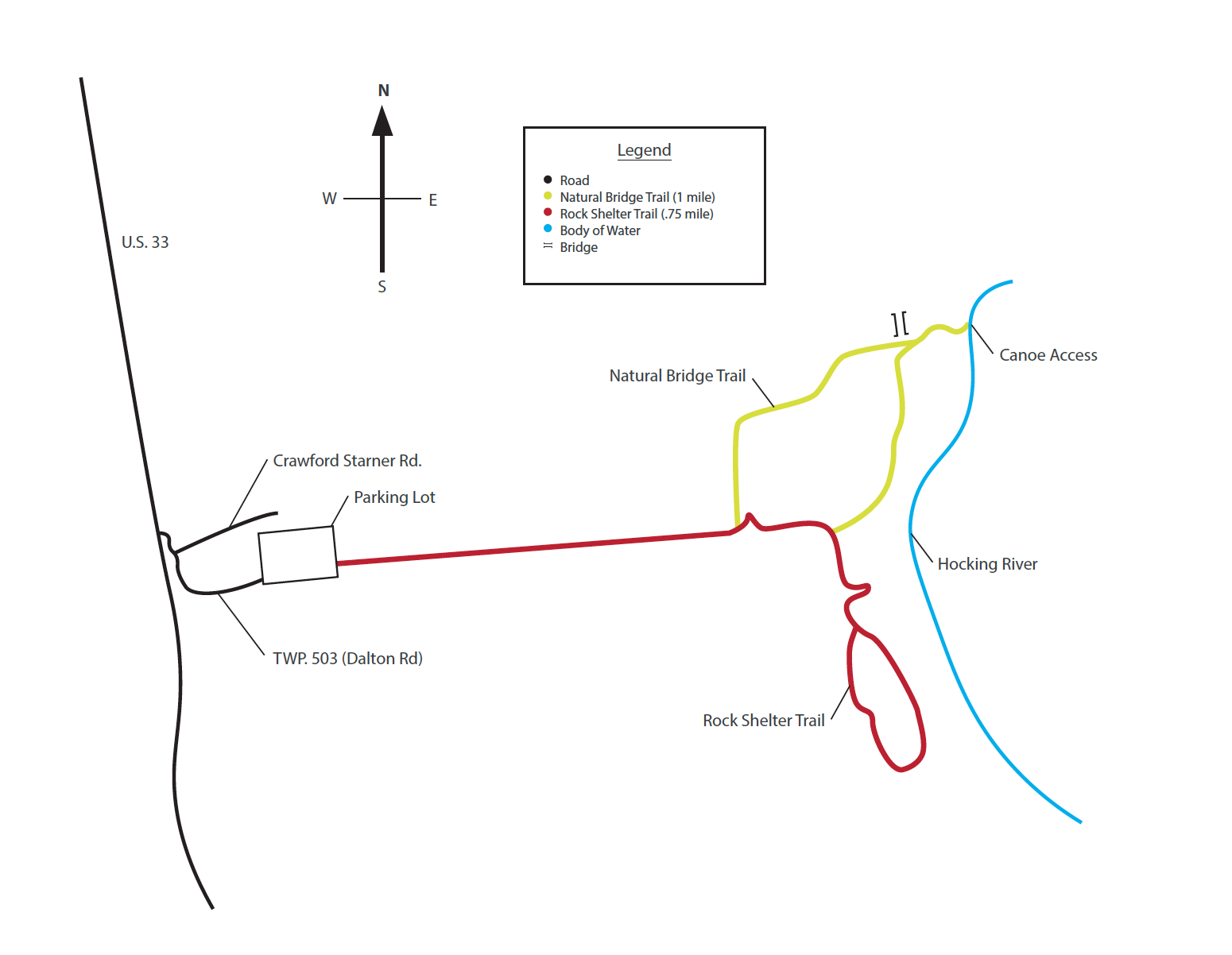
Rockbridge is the largest of Ohio’s twelve natural rock bridges. It spans more than 100 feet, reaching a maximum width of about 20 feet and arching over a ravine. A seasonal waterfall cascades down into a plunge pool from a height of 50 feet.
Rockbridge originated millions of years ago, when Ohio lay under a warm inland sea. Rivers flowed into the body of water, carrying both fine and coarse grained sands which settled to the sea bottom. Over the centuries, the accumulating sand thickened, compressed and formed the hard sedimentary rock known as Black Hand Sandstone. Eventually, great pressure from beneath the earth's surface caused the land in eastern North America to rise, forming the Appalachian Mountains. The inland sea soon drained away, exposing the newly uncovered rock layers to steady erosional processes. The natural bridge soon began emerging in all its grandeur. Wind, rain and percolating groundwater worked together for centuries, carving a deep cave-like recess in the softer midportion of the Mississippian Black Hand Sandstone. Gradually, erosional forces also worked along a natural joint plane some distance behind the brink of the cliff. Over the centuries, this ongoing process has widened the crevice, and all that remains of the overhanging ledge is the narrow rock arch.